By Emilia Wellesley · Published May 4, 2026 · Updated May 13, 2026
Last reviewed: May 4, 2026.
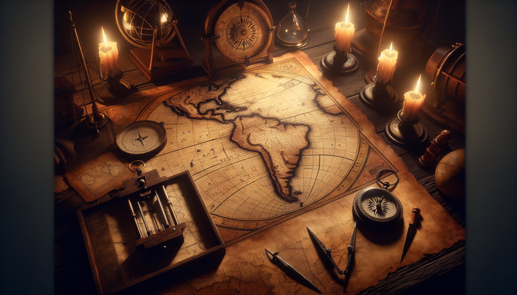
The Piri Reis Map, created in 1513 by the Ottoman admiral and cartographer Piri Reis, stands as a significant artifact in the study of ancient cartography. This ancient document provides valuable information on the geographical knowledge during the early 16th-century, shedding light on the maritime expertise of the era and the Age of Discovery.
Unpacking the Geographical Enigmas of the Piri Reis Map
The Piri Reis Map, a seminal relic of cartographic history, was composed in 1513 under the aegis of the mighty Ottoman Empire by the acclaimed admiral and cartographer Piri Reis. This historic piece intriguingly blends the navigational wisdom amassed over centuries with the elaborate art of ancient map making, representing a pivotal moment in the Age of Discovery.
The Intricacies of Mapping the Known and the Unknown
Central to the map's allure is its astonishing depiction of diverse regions, particularly emphasizing the eastern coastline of South America and the enigmatic outlines resembling the Antarctica coastline. The specificity with which South America is depicted stands as a testament to the remarkable advancements in geographical understanding at the time, yet it's the speculative rendering of what might be the Antarctic coast that captivates scholars and enthusiasts alike. The apparent precision raises provocative questions about the extent of pre-modern geographical knowledge and the sources from which Piri Reis might have drawn his information.
Navigating Through the Myths and the Maps
Notably, the Piri Reis Map amalgamates known geographical features with fantastical elements, commonly found in ancient cartography. This blending underscores a time when the edges of the known world were ripe for exploration and discovery, marred equally by documented voyages and maritime folklore. The delineations of the Andes Mountains, alongside depictions of mythical islands and sea monsters, offer a vivid narrative of how Renaissance mapmakers like Piri Reis negotiated scientific knowledge with legends of the time.
Reflections on Longitude and Latitude
One of the most academically stimulating aspects of the Piri Reis Map is its uncharacteristically accurate longitudinal coordinates—uncommon in a period where precise latitude calculations were evolving but longitude remained a mystery. Theories abound on how Piri Reis achieved such accuracy; suggestions range from inheriting refined data from ancient sources like charts from the Library of Alexandria, to utilizing advanced navigational tools which were possibly detailed in lost or uncredited cartographic documents of earlier mariners.
A Cartographic Convergence of Cultures
The Piri Reis Map also serves as a narrative of cultural and informational exchange across diverse civilizations. It’s speculated that Piri Reis had access to maps and charts from both Islamic and European traditions, and possibly from the voyages of explorers like Christopher Columbus. The map’s annotations, written in Turkish, provide insights into the admiral’s sources and thoughts, illustrating a vibrant dialog between his own observations and those inherited from the annals of ancient cartographers. These notes hark back to a time when mariners and mapmakers from different worlds shared the seas’ secrets, albeit unknowingly.
Piecing Together the Ancient Puzzles
As students of history and ancient wisdom, we continually grapple with the authenticity and accuracy of artifacts like the Piri Reis Map. What portions of these ancient documents can be taken as factual representations, and what should be attributed to the cartographers’ conjectures or artistic freedom? This enduring enigma makes the Piri Reis Map not only a tool of navigation but a subject of perpetual scholarly debate, inviting us to ponder on the historical breadcrumbs left on parchment by Piri Reis.
Through the intricate lines and faded landforms of the Piri Reis Map, we find more than just a guide to ancient shores; we uncover a story of human curiosity, the relentless pursuit of understanding our world, and the boundless imagination that fuels both science and myth. This map does not merely depict the world as it was seen; it invites us to see the world as it was dreamed.
Sources and Influence in Cartography
Integration of Various Cartographic Sources
The Piri Reis Map is renowned not just for its detailed depiction but also for its assembly of information from diverse and culturally rich origins. Piri Reis himself annotated on the map that he referred to about twenty charts and mappa mundi (world maps), including what he claimed were charts crafted by Christopher Columbus. This blend of sources showcases a remarkable example of early modern intercultural exchange and synthesis in cartography.
- Diverse Sources: The map integrates information from multiple, culturally diverse sources including world maps and charts by navigators like Columbus.
- Link to Alexandria: It's believed some of the map's content could have indirectly originated from the legendary Library of Alexandria, through copies of its charted content that survived the library’s tragic destruction. This connection not only emphasizes sourcing but also forms a narrative bridge linking the maritime legacies of ancient civilizations to the Renaissance navigators.
Impact of the Ottoman Empire’s Naval Power
The creation of the Piri Reis Map coincided with the peak of the Ottoman Empire’s naval power, underlining the empire's strategic and intellectual investment in maritime exploration and cartography.
- Strategic Use: The Ottomans, driven by the need to administer a sprawling empire, aggressively pursued geographic knowledge, paralleling their expansion across the Mediterranean and into the Indian Ocean.
- Cartographic Advancements: The strategic utility of such maps, which were essential for navigation, territorial control, and military planning, cannot be overstated. The Piri Reis Map was more than a scholarly pursuit; it was a navigational tool and a method of asserting territorial ambitions.
Furthermore, both the sekil (image or map) and textual information on the map reflect Piri Reis's understanding and assertions of the geopolitical realities of the time, influenced undoubtedly by the imperial politics and the necessity for comprehensive maritime knowledge for economic and military planning.
- Detailed Regions: The map’s precision in detailing the Mediterranean, a region of primary interest to the Ottoman naval strategy, underscores its utility for the empire’s ambitions to dominate both land and sea routes.
In conclusion, the Piri Reis Map stands as a testament to the confluence of cultural exchanges, driven by an empire’s aspirations and a cartographer’s ingenuity. Its accuracy and detail not only guided sailors of the time but continue to guide historians and geographers in understanding the scope and scale of maritime knowledge and imperial ambition in the early 16th century.
Technical Aspects of the Map
Cartographic Techniques and Navigation
The Piri Reis map, created in 1513, features a complex array of cartographic techniques that highlight the period's sophisticated knowledge, especially within the Ottoman Empire. A key aspect of Piri Reis's method is his use of portolan charts, critical for maritime navigation:
- Purpose of Portolan Charts: Mainly utilized for navigating waters, these charts are known for their detailed depiction of shorelines and ports.
- Techniques Used: Made possible through observational reckonings and compass directions, aligning the map accurately with maritime needs of that era.
The map's meticulous adherence to known latitude and longitude underscores the evolving precision in early navigational sciences. Notably, the map features:
- Depiction of the South American Coastline: Partly illustrated with surprising accuracy for its time.
- Source Material: Piri Reis had access to diverse sources, including charts from Christopher Columbus’s voyages and possibly ancient documents rumored to be from the Library of Alexandria.
His ability to integrate these diverse sources into a coherent, navigable map highlights not just craftsmanship but a deep understanding of various cartographic narratives prevalent during that period.
Geographic Knowledge Depicted
The map transcends mere geographical documentation; it blends real-world features with embellishments or speculations about unknown territories:
- Sources: Piri Reis annotated that he used 20 different sources to compile the map’s details, illustrating an immense integration of knowledge.
- Speculative Geographies: Includes the depiction of the Andes Mountains and hypothetical renderings of the Antarctic coast—areas unexplored at the time.
This duality in the map, combining accurate depictions of the Atlantic coasts with speculative geographies of mythical islands and uncharted lands, showcases:
- Knowledge and Limitations: A vivid representation of both the mariner’s knowledge and the limitations faced during that era.
- Annotations: Piri Reis's notes, especially on the Caribbean, hint at a pre-Columbian oceanic knowledge base, enriching our understanding of ancient mapmakers' perspectives—a curious mix of accuracy and mythology.
Incredibly, the map's accurate longitudinal stretches are uncharacteristic of the cartographic norms of the era:
- Anomalies and Scholarly Interest: These accuracies have piqued modern scholarly interest, positing the map as a critical document for studying pre-modern geographical knowledge.
- Navigation Tools: The correct geographical dimensions suggest that Piri Reis effectively mastered the use of the kamal—an ancient navigational tool—significantly reducing latitude errors common among Renaissance cartographers.
In conclusion, the technical examination of the Piri Reis map reveals layers of navigational wisdom and cartographic skill. It serves as a bridge between historical maritime exploration and sophisticated mapmaking, highlighting a significant era in nautical history. Through this analysis, we decipher not only lands and seas but the relentless human spirit committed to exploring the unknown.
Speculations and Modern Interpretations
Unveiling the Antarctic Coastline Enigma
A standout aspect of the Piri Reis Map that continues to fascinate scholars and conspiracy theorists alike is its depiction of what appears to be the Antarctic coastline—remarkably charted before the continent was officially discovered. This compelling feature of the map suggests that ancient cartographers might have had knowledge of geographical features that were not officially recognized until centuries later. This speculation hinges on the map's portrayal of a landmass where Antarctica would be, largely free from its current, massive ice cover. If substantiated, this detail could dramatically shift our understanding of pre-modern geographical knowledge and the capabilities of ancient mariners.
Mysteries of Lost Civilizations and Uncharted Lands
The map's potential connection to lost civilizations stirs up an equally intriguing debate. Some theorists posit that the astonishing accuracy with which some regions are depicted might signify not just advanced cartographic technologies but also possible interactions with yet-to-be-discovered cultures or civilizations. This line of thought is bolstered by the fact that Piri Reis himself noted using sources that were derived from the "library of Alexandria," famous for its lost wealth of ancient knowledge. Could the map be a residual echo of a more globally connected ancient world than previously thought?
This section also touches upon the role of ancient mariners and the extent of historical navigation. It raises questions about the extent of their voyages and suggests that their exploration might have been more extensive than documented history typically acknowledges. This notion introduces a fascinating twist to the conventional understanding of historical timelines and maritime exploration, potentially pointing to a world that was far more interconnected in ancient times than previously considered.
Connecting the Dots with Historical Navigation Techniques
The exploration of the map’s speculative portrayals is incomplete without discussing the navigational prowess it suggests. The representation of such distant lands implies not only a profound understanding of cartography but also advanced navigational techniques that would have been necessary for reaching these regions. It underscores the possible use of sophisticated ancient tools and astronomic knowledge, akin to celestial navigation, which could have guided mariners across uncharted waters to shores unknown to the broader civilization of their time.
Bridging Myth and Reality in Ancient Cartography
Lastly, the interplay of myth and reality seen in the map’s depictions—where factual geographic knowledge meets tales of mythical islands and creatures—serves as a metaphor for the bridge between the known and the mystical during the Age of Discovery. This aspect highlights how cartographers of the time not only sought to chart the physical world but also grappled with the myths and legends handed down through generations, which were often considered as factual as the lands they had touched.
In summary, the Piri Reis Map is a canvas not just of continents and coasts but of the human spirit's boundless curiosity. It remains a pivotal artifact in deciphering how ancient societies viewed and understood their world – as vast, mysterious, and richly woven with tales of the fantastical and the real. Each line and contour inked on the map continues to offer modern-day scholars and dreamers alike a glimpse into the daring explorations and intellectual aspirations of our forebears.
The Map’s Role in Nautical Exploration
The Piri Reis Map, dated 1513, is not merely a piece of naval art but a profound indicator of sophisticated nautical exploration at the time, serving as an instrumental blueprint for later maritime ventures. What sets it apart are the intricacies of its maritime routes and detailed depictions of coastlines that, even today, stir a mix of awe and intrigue among historians and cartographers alike.
Influence on Later Explorations
The map's influence on subsequent explorations is a testament to its detail and accuracy. For instance, Amerigo Vespucci and Vasco da Gama, pivotal figures in maritime discovery, may have gleaned insights from this cartographic masterpiece to bolster their navigational strategies. It’s widely conjectured that Vespucci’s mapping of the New World and da Gama’s routes to India could have been influenced by the detailed depictions of coastlines and maritime paths laid out by Piri Reis. The map’s comprehensive portrayal of the Atlantic coasts of Europe and North Africa, extending to the Caribbean and parts of Brazil, provided a level of detail unprecedented in early 16th-century cartography, making it an invaluable resource in an era driven by the fervor of exploration.
The Map’s Educational Use in Early Modern Europe
In early modern Europe, the spread and utility of geographic knowledge were pivotal in navigating the then-mysterious seas. The Piri Reis Map served an educational purpose unparalleled by other nautical charts of the time. It found its place in the rudimentary maritime academies of Portugal and Spain, where it likely aided in teaching aspiring navigators the complexities of oceanic voyages. The map’s detailed geographical representations and annotations could have functioned not only as navigational aids but also as instructional tools, offering insights into the practical applications of combining direct observation with information gathered from other explorers.
Moreover, the map might have influenced the cartographic conventions of the time, leading to improved accuracy in maritime maps, known as portolan charts, which were crucial for the age of discovery. The presence of meticulously detailed cartographic elements like compass lines and rhumb lines on the map indicates an advanced understanding of navigation principles crucial for the training of sailors and explorers during that time.
By bridging the gap between ancient cartographic knowledge and the burgeoning curiosity of Renaissance navigators, the Piri Reis Map underscored the continuity and evolution of maritime exploration, rendering it not just an artifact but a pivotal instrument of historical education and advancement in marine exploratory practices.
Preservation and Legacy
Rediscovery and Historical Value
The serendipitous rediscovery of the Piri Reis Map in 1929 by a German theologian, Gustav Adolf Deissmann, in the hallowed halls of Istanbul's Topkapi Palace Library, pivoted the global understanding of early modern exploratory cartography. Forgotten for centuries, entombed within a dusty collection, the map reverberated through the corridors of maritime history revealing unprecedented accuracies and anachronistic geographical delineations.
- Geographical Coverage: Marked by its depiction of the western coasts of Europe and North Africa alongside the Brazilian coastline.
- Significance: The map serves as a tantalizing testimony to the synthesis of Ottoman maritime prowess and an accumulated repository of navigational knowledge.
- Impact of Rediscovery: This event not only emphasized the historical significance of the map but also rekindled interest in the comprehensive maritime explorations of the Age of Discovery and the role of early cartographers like Piri Reis in enriching Europe's geographical boundaries.
Influence on Historical and Modern Cartography
The impact of the Piri Reis Map transcends its time, offering modern-day scholars and cartographers vivid insights into the cartographic expertise and ambitions of the 16th century.
- Ancient Sources: Its potential use of sources like charts from Christopher Columbus or materials harking back to the Library of Alexandria underscores the map’s role as a confluence of ancient and Renaissance navigational wisdom.
- Scholarly Interest: This relic from the past continues to inspire both awe and scholarly critique, pivotal in understanding the progression from rudimentary sketches of the known world to more detailed and scientifically-oriented representations.
- Maritime and Cartographic Linkage: The map fortuitously bridges disparate epochs — it links the ambitious maritime undertakings of the Ottoman Empire, the navigational curiosities of explorers like Columbus and Vespucci, and the burgeoning cartographic sophistication that typified the Renaissance.
- Educational Value: As an educational tool, the Piri Reis Map exemplifies the perpetuation of nautical and geographic knowledge, underscored by its detailed portrayal of pre-modern cartography and its developmental trajectory into the more precise mapping conventions of later centuries.
In sum, the rediscovery and subsequent analysis of the Piri Reis Map illuminate its dual legacy as both a historical artefact and a beacon of cartographic evolution, its riddles and accuracies continuing to unfold through modern interpretative endeavors and technological advancements in historical research.
Challenges in Studying Ancient Maps
Unraveling Cartographic Mysteries
Ancient maps, such as the Piri Reis Map, encapsulate a world of mysteries and historical ambiguities that continue to puzzle and fascinate scholars. Deciphering these age-old cartographic enigmas involves teasing out the intertwined threads of navigation history, geographical knowledge, and myth.
For historians, one major challenge involves:
- Determining Sources: Determining the sources from which ancient cartographers like Piri Reis drew their information is critical.
- Examination: The process involves a painstaking examination of medieval and early modern cartographic techniques.
- Deciphering Inscriptions: Scholars must decipher faded inscriptions and correlate depicted geographical details with known historical data.
- Separating Fact from Fantasy: Separating factual depictions from the fantastical—such as speculative territories or mythical islands often illustrated in ancient maps—requires a blend of historical insight and critical analysis.
The Role of Technology in Cartographic Research
With advancements in technology, the field of cartographic research has seen a significant transformation in how ancient maps are studied. For instance:
- Digital Imaging and Scanning: Enhanced scanning techniques allow for the non-invasive examination of delicate ancient documents, revealing intricate details invisible to the naked eye.
- Spectral Imaging: Tools such as spectral imaging can discern previously obscured or overwritten features that may hold clues to understanding the map’s origins and purposes.
- Digital Archiving: This technology offers a means to preserve these ancient treasures while making them accessible to a global community of scholars and enthusiasts.
These technological interventions not only provide a clearer picture of the physical attributes of ancient maps but also facilitate a deeper understanding of the cultural and historical contexts within which they were created.
Conclusion:
Together, these methods form a bridge between past knowledge and modern inquiry, unraveling cartographic puzzles that have awaited answers for centuries. This confluence of history and technology not only broadens our understanding of ancient seafaring and cartography but also underscores the continued relevance of ancient wisdom in contemporary scholarly endeavors. By unraveling these mysteries, each discovery adds a piece to the vast jigsaw puzzle of human history, showing us where we have been and hinting at where we might go.


