By Emilia Wellesley · Published May 6, 2026 · Updated May 13, 2026
What Was Vinland, and What Have the Vikings Left Behind?
Vinland was the Old Norse name for a forested coastal region of northeastern North America that Greenlandic Norse explorers reached around the year 1000 CE. The clearest physical trace is at L’Anse aux Meadows, a small Norse base camp on the northern tip of Newfoundland, dated by tree rings to 1021. The sagas describe more.
Two thirteenth-century Icelandic prose narratives, the Saga of the Greenlanders and the Saga of Erik the Red, preserve a version of these voyages composed roughly two centuries after the events. They are not field reports. They are family memory polished by generations of telling, and they disagree with one another on important points. The single archaeological site that closes the loop on their geography sits on a wind-scoured Newfoundland headland, where Helge Ingstad (1899-2001) and Anne Stine Ingstad (1918-1997) excavated eight Norse-style sod buildings between 1961 and 1968.
What follows treats the Viking voyages to Vinland as a case where text and dirt meet, sometimes match, and sometimes leave a gap that no one can yet close. The story belongs as much to the Beothuk and Dorset peoples whose coasts the Norse touched as to the seafarers who briefly slept there, and it sits inside the broader landscape of historical and archaeological mysteries that still hold open questions.
The Two Sagas and What They Disagree About
The medieval Icelandic record of the voyages survives in two prose works, written independently in the early thirteenth century from older oral traditions. They are usually called the Vinland Sagas. Both center on the same family but tell the discovery story differently.
Grænlendinga Saga
The Saga of the Greenlanders credits the first sighting to Bjarni Herjolfsson, a merchant blown off course around 986 CE while sailing from Iceland to his father in Greenland. Bjarni reportedly saw three different landfalls but did not go ashore. His ship and his story were later acquired by Leif Erikson (c. 970s-c. 1020), son of Erik the Red, who organized a deliberate expedition retracing Bjarni’s route in reverse. This text describes six successive voyages, including those of Leif’s brother Thorvald, the trader Thorfinn Karlsefni and his wife Gudrid, and Erik’s daughter Freydis.
Eiríks Saga Rauða
The Saga of Erik the Red tells a different first-contact story. Here Leif sights the new land by accident on his way home from Norway, blown off course while carrying a Christian missionary commission from King Olaf Tryggvason. The saga then concentrates its long middle on the expedition of Karlsefni, a major Icelandic figure, and on Gudrid Thorbjarnardottir, who would later be celebrated as a widely traveled woman of the Norse world. Most working scholars treat the Greenlanders’ Saga as the older and structurally more reliable narrative, while reading Erik’s Saga as a later literary recasting that promotes Karlsefni’s lineage.
L’Anse aux Meadows: The Site That Closed the Question
For most of the twentieth century, the Vinland sagas were treated as a legend that might or might not contain a grain of geographical fact. The find that changed this came not from a university expedition but from a Norwegian husband-and-wife team following a hunch and a tip from a fisherman.
Helge and Anne Stine Ingstad’s Newfoundland Years
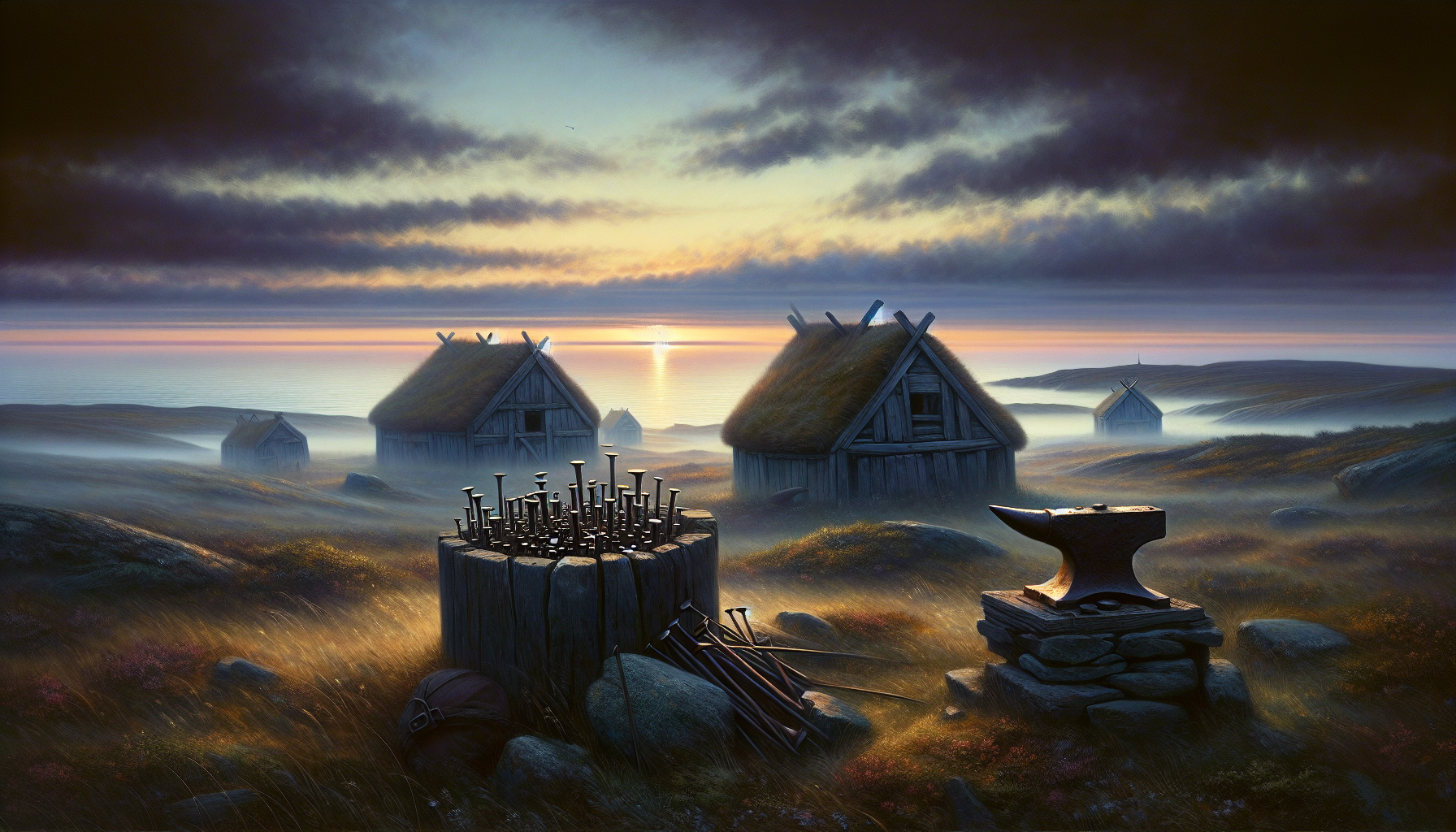
In 1960, after years of coastal reconnaissance, Helge Ingstad reached the village of L’Anse aux Meadows on Newfoundland’s Great Northern Peninsula. A local resident named George Decker walked him to a set of grassed-over ridges that the villagers called the “old Indian camp.” Anne Stine Ingstad, an archaeologist trained in Scandinavian field methods, returned the next summer with an international team. Over seven seasons from 1961 to 1968 they uncovered the remains of eight Norse-style buildings, including a long hall, smaller dwellings, an iron smithy, and a carpentry workshop, all built of sod over wooden frames in a manner familiar from contemporary Greenland and Iceland, according to the Encyclopaedia Britannica. Iron boat nails, a bronze ringed pin, a soapstone spindle whorl, and a bone needle established that the inhabitants included both men and women and were not local.
Birgitta Wallace and Parks Canada’s Long Excavation
Birgitta Wallace (1934-2025), a Swedish-Canadian archaeologist, joined Parks Canada in 1975 and took over the L’Anse aux Meadows research program in 1978, continuing it for the rest of her career. Wallace’s reading, published across decades of articles in Newfoundland and Labrador Studies and elsewhere, argued that the site was not a colony but a base camp: a beachhead used to repair ships and stage further exploration to the south. Three butternuts found in the deposits clinched the argument that the Norse had ranged at least as far as the Gulf of St. Lawrence, since butternut trees do not grow naturally north of New Brunswick. UNESCO designated the site a World Heritage location in 1978, the first in Canada.
How We Know It Was 1021
Carbon dating placed the L’Anse aux Meadows occupation in a wide window of roughly 990 to 1050 CE. That was acceptable but not satisfying. The precise year arrived only in 2021, through a method that pins archaeological wood to a single calendar year using the chemistry of the upper atmosphere.
The Cosmic-Ray Spike of 993
In 993 CE a sudden, intense burst of cosmic radiation, almost certainly a powerful solar storm, deposited a sharp spike of carbon-14 in the atmosphere. Trees alive that year incorporated the anomaly into their growth ring. Dendrochronologists in Germany, Ireland, Arizona, and Japan have all detected the same 993 signal in their reference chronologies. A piece of wood old enough to have been growing in 993 carries a built-in calendar mark, accurate to a single year.
Margot Kuitems and the Three Wood Pieces
In a paper published in Nature on October 20, 2021, Margot Kuitems and Michael Dee of the University of Groningen, working with Birgitta Wallace and the curators of the Parks Canada collection in Dartmouth, Nova Scotia, dated three pieces of fir and juniper from the site. Each had bark on the outermost ring, which gave the year of felling. Each contained the 993 spike. Counting the rings between the spike and the bark on each piece independently produced the same result: 1021 CE. The wood had been cut by metal tools, which Indigenous people in the area did not use, and it had been deposited in Norse occupation layers.
Where Was Vinland, Exactly?
The sagas describe three regions. Helluland, the “land of flat stones,” is consistently identified by working scholars with Baffin Island in present-day Nunavut. Markland, the “forest land,” fits the central forest belt of Labrador. Vinland is harder. The name means “wine land,” and the sagas describe wild grapes, salmon-rich rivers, mild winters, and self-sown wheat. None of these are easy to reconcile with northern Newfoundland.
Wallace and others have argued that L’Anse aux Meadows was Leif’s Leifsbúðir, the staging base, and that the sagas’ Vinland proper extended south into the Gulf of St. Lawrence and possibly to New Brunswick or Nova Scotia. The butternuts support this. Some scholars push the southern boundary further, into Maine or even south of Cape Cod, but no second confirmed Norse site has been found. The geographical identity of Vinland remains the open question of the field.
Who Were the Skraelings?
The Norse called the people they met in Vinland skrælingjar, a word the sagas use for both Indigenous Americans and, later, for the Thule Inuit they encountered in Greenland. The contact was not single. The sagas describe trade, then a misunderstanding involving a bull, then violence. Thorvald Erikson is killed by an arrow. Karlsefni’s people abandon their settlement under repeated pressure.
Beothuk and Dorset Possibilities
In Newfoundland and the Gulf of St. Lawrence, the most likely peoples the Norse met were the ancestors of the Beothuk, a culture later associated with red ochre body paint, and the Dorset Palaeoeskimo, who occupied parts of Labrador and the Arctic in the same centuries. Both possibilities sit close to the saga timing. The texts give too little physical detail to settle which group, or which mix of groups, the encounters involved. Honoring the historical priority of those communities, whose descendants and successor cultures continue to live in the region, is part of reading the sagas with care.
Patricia Sutherland and the Baffin Island Question
A separate body of research, led by Patricia Sutherland of the Canadian Museum of Civilization, proposed long-term Norse contact with Dorset peoples on Baffin Island in the eleventh through thirteenth centuries. Sutherland reopened excavations at Tanfield Valley on Baffin’s southeastern coast and reported European-style stone masonry, whetstones bearing copper-alloy traces, spun cordage made of Arctic hare and fox fur, and tally sticks similar to Norse types, as reported by National Geographic in 2012.
The work is contested. William Fitzhugh of the Smithsonian’s Arctic Studies Center has argued that several of Sutherland’s identifications, particularly the cordage, fit Dorset technology already in use centuries before the Norse arrival. Sutherland was dismissed from the museum in 2012 in a separate institutional dispute, and the Tanfield Valley material has not been published in a comprehensive monograph. The site remains a strong but unresolved candidate for Helluland-period Norse-Dorset contact, not a confirmed one.
The Vinland Map: A Forgery’s Long Goodbye
No discussion of Norse North America is complete without the manuscript that for half a century muddied the field. The so-called Vinland Map, acquired by Yale’s Beinecke Rare Book and Manuscript Library in the mid-1960s, appeared to show northeastern North America on a fifteenth-century parchment. If genuine, it would have been the earliest European depiction of the New World.
The 2021 Yale Verdict
In September 2021, Yale curator Raymond Clemens and a team of conservators announced the result of a multi-year analysis using X-ray fluorescence spectroscopy, Raman microscopy, and field-emission scanning electron microscopy. The map’s ink contained titanium dioxide in the form of anatase, a pigment first commercially produced in the 1920s, and the anatase particles were broadly distributed across every line of the map. An overwritten inscription on the parchment’s reverse appeared to have been altered to make the document seem authentically medieval. Yale’s official statement quoted Clemens directly: “The Vinland Map is a fake. There is no reasonable doubt here.”
The forgery’s exposure does not affect the archaeology. L’Anse aux Meadows had already settled the question of Norse arrival decades before. What the map’s collapse does is clear away a confounding artifact and leave the genuine evidence visible.
Why the Norse Did Not Stay
L’Anse aux Meadows shows occupation across a small handful of years, not a century. Karlsefni’s larger expedition, with livestock and women and an attempt at permanent settlement, lasted, by saga reckoning, only a few seasons before withdrawal. Several factors converge in the explanation.
- Distance from Greenland. The Greenlandic Norse colony itself was small, perhaps a few thousand people at its height. It could not spare the population for a transatlantic outpost.
- Resistance from Indigenous communities. The skraelings were neither a small nor a passive population, and their numbers grew the further south the Norse pushed. Sustained settlement would have required sustained conflict.
- The economics of timber. Wood, scarce in treeless Greenland, was the most likely real prize. A small base for staging cutting expeditions made more sense than a colony, and Markland was probably revisited for centuries afterward.
- Climate and isolation. The Greenland colony itself contracted and finally ended in the fifteenth century. The North Atlantic gateway closed before any larger movement to Vinland was possible.
What Vinland Means Now
The voyages were not, in their own time, a discovery in the European sense. They were an extension of an ongoing Norse Atlantic project that ran from Norway through the Faroes to Iceland to Greenland, and finally to a coast that already had its own peoples and its own thousands of years of history. The Norse came, the Norse left, and the encounter became saga. The archaeology recovered what survived: postholes, charcoal, three nuts, and a date.
For the Beothuk, the Mi’kmaq, the Innu, and the descendants of the Dorset and Thule, the Norse arrival is part of a much longer story of contact, one in which the European visitors of 1021 were neither the first outsiders nor the most consequential. Reading Vinland well means reading it as a chapter in their history as much as in Iceland’s.
Frequently Asked Questions
Did the Vikings really reach North America before Columbus?
Yes. The eight Norse buildings excavated at L’Anse aux Meadows in Newfoundland, dated by tree-ring analysis to 1021 CE, are unambiguous physical evidence of a Norse presence in North America roughly five centuries before the 1492 voyage of Christopher Columbus.
How was the year 1021 established?
In 2021, Margot Kuitems and Michael Dee of the University of Groningen used a 993 CE cosmic-ray spike, visible as a sharp carbon-14 anomaly in tree rings worldwide, as a calendar marker. Three Norse-cut wood pieces from L’Anse aux Meadows showed the same spike, and counting outward to the bark gave a felling date of 1021 for each piece.
Where was Vinland?
The single confirmed Norse site is at L’Anse aux Meadows on Newfoundland’s northern tip. Saga descriptions of grapes and butternuts, plus three actual butternuts found at the site, indicate that Norse expeditions ranged south at least to the Gulf of St. Lawrence and probably into New Brunswick. The exact southern boundary remains debated.
Who discovered L’Anse aux Meadows?
The Norwegian explorer Helge Ingstad and the archaeologist Anne Stine Ingstad identified the site in 1960, after a tip from local resident George Decker. Birgitta Wallace took over the long-term Parks Canada research program in 1978 and shaped most of what is now the standard reading of the site.
Was L’Anse aux Meadows a Viking colony?
Most working archaeologists treat it as a base camp rather than a permanent settlement. The buildings show occupation across a relatively short span, perhaps a single decade or less. Birgitta Wallace argued that it served as a beachhead for staging exploration, ship repair, and resource gathering, especially timber, further south.
Who were the skraelings the Norse encountered?
The most likely candidates in Newfoundland and the Gulf of St. Lawrence are the ancestors of the Beothuk and the late Dorset Palaeoeskimo. The sagas do not give enough physical detail to determine which Indigenous community, or mix of communities, the Norse met. Both possibilities are consistent with the regional archaeology of around 1000 CE.
Is the Vinland Map authentic?
No. In September 2021, Yale University formally confirmed the Vinland Map is a twentieth-century forgery, based on the presence of titanium dioxide in the anatase form throughout the map’s ink lines. The pigment was first commercially produced in the 1920s. Yale curator Raymond Clemens stated the case was definitively closed.
What did Patricia Sutherland find on Baffin Island?
Sutherland reopened excavations at the Tanfield Valley site on southern Baffin Island and reported finds suggesting prolonged Norse-Dorset contact, including European-style masonry, whetstones with copper-alloy traces, and Arctic-hare and fox-fur cordage. The interpretation is contested by Smithsonian scholars and has not been published as a comprehensive monograph.
Why did the Norse abandon Vinland?
The Greenlandic Norse colony was small and could not spare the population for a permanent transatlantic settlement. Resistance from large Indigenous communities, the long supply line, and the gradual contraction of Greenland itself made colonization impractical. Markland, the Labrador forest, was probably revisited for centuries as a timber source.
What survives in writing about the voyages?
Two thirteenth-century Icelandic prose works, the Saga of the Greenlanders and the Saga of Erik the Red, preserve the main narrative. They were composed roughly two centuries after the events, draw on older oral tradition, and disagree on key points including who first sighted the new land. Used carefully alongside the archaeology, they remain the principal textual sources.


