By Emilia Wellesley · Published May 5, 2026 · Updated May 13, 2026
Last reviewed: May 5, 2026.
What Was the Indus Valley Civilization?
The Indus Valley Civilization was a Bronze Age urban culture that flourished from roughly 2600 to 1900 BCE across the floodplains of the Indus and now-dry Ghaggar-Hakra rivers. Its planned cities, standardized weights, copper craft, and undeciphered script make it one of the most accomplished and least understood civilizations in the human record.
Few ancient cultures present so coherent a face and yet refuse to speak. Mohenjo-daro and Harappa were laid out on grids. Brick sizes were standardized across a territory larger than Egypt and Mesopotamia combined. Drains ran beneath the streets. Seals carved with a humped bull and a script of perhaps four hundred signs sealed bales of cotton and copper. Then, sometime around 1900 BCE, the cities thinned and the script vanished. What is left is a civilization legible in its objects and silent in its words.
This article traces the Indus from its first survey trenches to its disputed ending and shows how the open questions sit alongside the broader landscape of historical and archaeological mysteries.
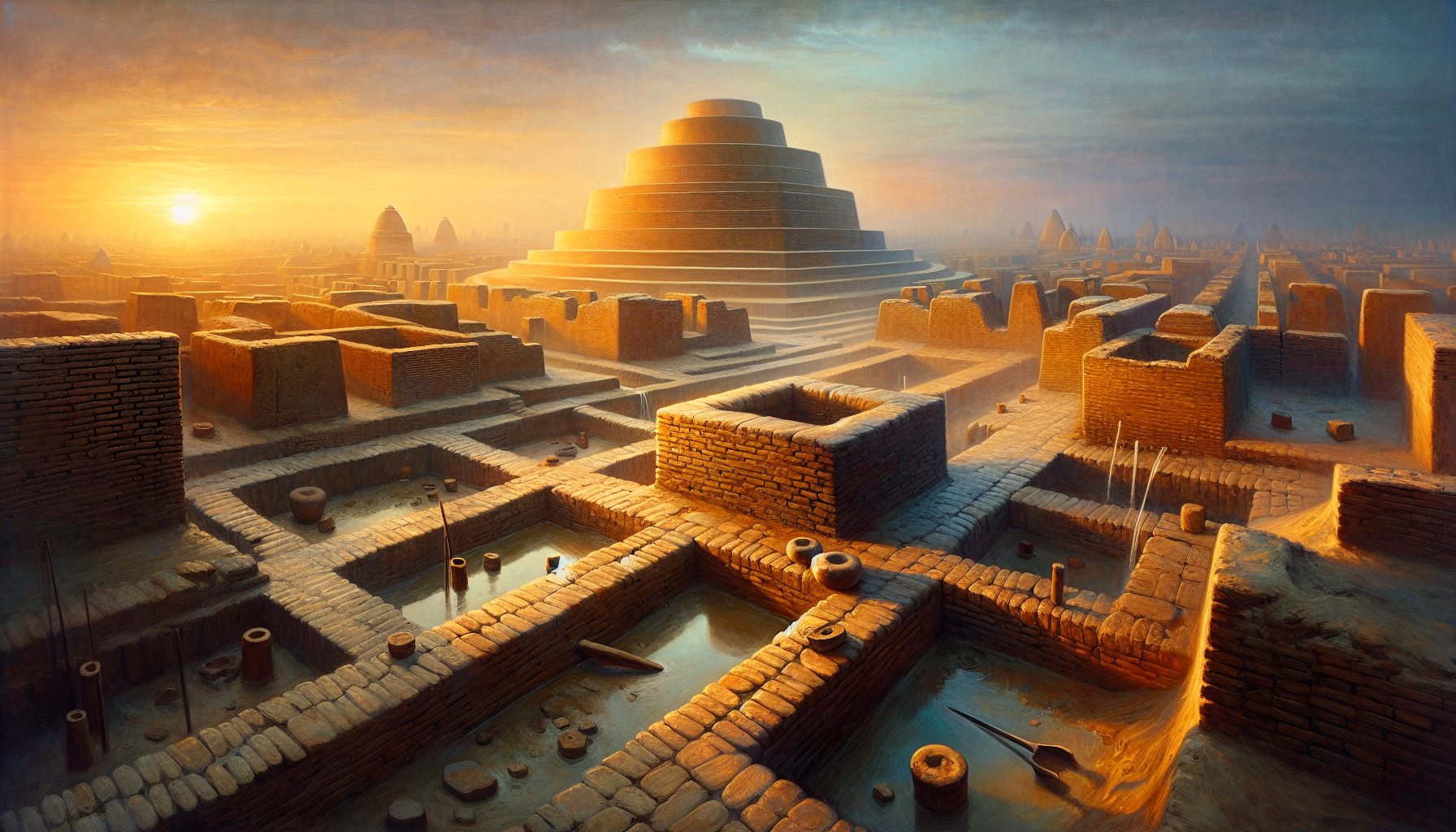
The Cities the Indus Built
More than fifteen hundred Indus settlements have been mapped between the Iranian plateau and the Yamuna basin, with five sites earning the label “city” by population and planning: Mohenjo-daro, Harappa, Dholavira, Rakhigarhi, and Ganweriwala. Each shows a deliberate civic mind at work, and yet each preserves local accents that complicate any single template.
Mohenjo-daro: The Mound of the Dead
Mohenjo-daro, in present-day Sindh, Pakistan, was identified by R. D. Banerji in 1922 and excavated under John Marshall (1876-1958) for the Archaeological Survey of India. The Lower Town spreads in north-south streets at near-right angles to a raised western citadel, where a mortar-sealed Great Bath and a granary-like platform sit beside what may be an assembly hall [1]. Houses accessed the streets through narrow lanes. Almost every dwelling held a brick-lined well. Wastewater dropped into terracotta drains that vented to settling chambers, an infrastructure unmatched until Roman engineering more than a thousand years later [1].
Harappa: The Type-Site
Harappa, on the Ravi River in Punjab, gave the civilization its alternate name. Daya Ram Sahni’s 1921 trenches, supplemented by Mortimer Wheeler’s 1946 stratigraphy, revealed a sequence of mud-brick and baked-brick walls, working platforms, and cemeteries. Jonathan Mark Kenoyer (b. 1952), co-director of the Harappa Archaeological Research Project, has argued that craft neighborhoods organized the city: shell-workers near the gates, copper-smiths in dedicated lanes, faience kilns on the edges. Each ward produced its own micro-economy and traded across the urban fabric [2].
Dholavira: Reservoirs Cut from Stone
Dholavira, in the salt-pan island of Khadir Bet in Gujarat, India, was excavated by R. S. Bisht beginning in 1989. The site is unusual on two counts. It is built of dressed stone rather than mud-brick, and it is ringed by a sequence of sixteen rock-cut reservoirs, the largest holding more than thirty million liters. A row of ten Indus-script signs, each over thirty centimeters tall, was found set into a gateway sign-board, the largest known inscription in the script. Whatever the signs meant, they were meant to be read.
The Script Nobody Has Read
Roughly four thousand inscribed objects survive: square steatite seals, copper tablets, pottery graffiti, and a few inscribed weights. The signs number between four hundred and seven hundred depending on how variants are counted, and most inscriptions are short, often only four or five characters. According to Britannica’s overview of the script, this brevity is the central obstacle: there is no Rosetta-style bilingual, no long literary text, and no attested speakers of any descendant language [3].
The Decipherment Camps
Three reconstructions compete. The first, advanced most prominently by Asko Parpola (b. 1941) of the University of Helsinki, treats the signs as a logo-syllabic writing system encoding an early Dravidian language. The second, defended by Indian scholars including S. R. Rao, reads the signs as a form of early Indo-Aryan, often arguing for continuity with later Brahmi. The third, proposed by Steve Farmer, Richard Sproat, and Michael Witzel in 2004, holds that the signs are not a writing system at all but a non-linguistic symbolic code analogous to medieval European heraldry. Each reading remains an active hypothesis. The seal corpus is too short to falsify any of them on internal evidence alone.
What Computational Studies Suggest
Statistical analyses of sign frequency and sequencing, including the Markov-chain studies by Rajesh P. N. Rao and colleagues published in 2009, return entropy patterns broadly consistent with linguistic writing. The findings sit awkwardly with Farmer’s non-linguistic hypothesis, but they do not identify the language. As of 2026, the script is the longest-running open problem in Bronze Age archaeology, and the Harappa Archaeological Research Project hosted online by Kenoyer and curator Omar Khan continues to publish new finds and concordances [2].
What the Indus Made and Traded
The material evidence is thicker than the textual. Indus craftspeople fired carnelian beads using a long-bake etching technique that has since been replicated experimentally; weighed grain on cubical chert weights graded in a binary-decimal system accurate to within a fraction of a percent; smelted copper from Aravalli ore; and threaded dyed cotton, the earliest cotton textile yet recovered. The standardization across sites is the surprise. A weight from Lothal matches a weight from Harappa to within tolerance. Bricks from Dholavira and Mohenjo-daro share the same 1:2:4 ratio.
Long-Distance Trade
Mesopotamian cuneiform records from Ur and Lagash refer to Meluhha, a distant land trading carnelian, lapis lazuli, ivory, hardwoods, and “fish-eyes,” likely pearls. The Smithsonian’s history of South Asian trade situates Meluhha squarely in the Indus orbit, with a Meluhhan translator even attested in an Akkadian text under Sargon (c. 2334-2279 BCE) [4]. Indus-style seals have been recovered at Failaka and Bahrain. A seafaring port at Lothal, with a brick-lined basin many archaeologists read as a tidal dockyard, anchors the Indian end of that route.
How the Cities Ended
Sometime between 1900 and 1700 BCE, the urban phase contracted. Standardized weights stopped circulating. The script disappeared from the seal record. Mohenjo-daro shrank, Harappa’s craft quarters dwindled, and Dholavira was abandoned in stages. Three hypotheses for the decline coexist in current scholarship, and the evidence rewards holding all three at the same time.
The Climate Hypothesis
Liviu Giosan and an international team published a 2012 paleoclimate reconstruction in the Proceedings of the National Academy of Sciences showing that the summer monsoon weakened progressively across the third millennium BCE, drying the Ghaggar-Hakra channel and shrinking the agricultural margin that had supported dense Indus populations [5]. Sediment cores from the Indian Ocean and the Thar Desert margin agree on the trend. The dating brackets the urban contraction. Climate is now the leading frame.
The Aryan Migration Hypothesis
An older reading, given its harshest form by Mortimer Wheeler in his 1947 phrase “Indra stands accused,” argued that incoming Indo-Aryan speakers destroyed the cities. Wheeler’s evidence, a cluster of unburied skeletons in a single Mohenjo-daro lane, has not held up under reanalysis; the bodies span centuries and several causes of death. Mainstream archaeology no longer accepts a destructive invasion. A slow linguistic and demographic infiltration after the urban collapse remains plausible, and recent ancient-DNA work by David Reich and Vagheesh Narasimhan in 2019 traces steppe-related ancestry entering northwest South Asia after 2000 BCE.
The Systemic-Failure Hypothesis
Gregory Possehl (1941-2011), in his 2002 synthesis The Indus Civilization: A Contemporary Perspective, proposed that no single shock killed the cities. Trade networks frayed as Mesopotamia’s appetite for Indus carnelian shifted under the Akkadian collapse; salinization compromised irrigated fields; the script-bearing administrative class lost the institutional anchor that had standardized weights and seals across a thousand kilometers. Rita Wright’s 2010 study The Ancient Indus emphasizes the same systemic reading, with regional populations dispersing into smaller settlements rather than vanishing.
Holding the Three Together
A weakened monsoon does not, by itself, dismantle a city. A migrating population does not empty a planned grid. A trade-network failure does not erase a script. The evidence supports a slow compounding of stresses across two centuries, in which climate set the stage, infrastructural fragility removed the buffers, and demographic shifts filled the eventual silence. Each hypothesis remains a real reading.
Why the Indus Still Resists Easy Reading
Several features make the Indus genuinely strange when set against its Bronze Age peers. There are no certain temples, no kings on thrones, no monumental tombs of the kind that organize Sumerian, Egyptian, and Shang archaeology. The civic art is small, intimate, and largely uniform: the famous “priest-king” steatite bust from Mohenjo-daro is no taller than a hand. The seals show animals, ritual scenes, and a horned figure sometimes called proto-Shiva, but no royal portrait. Either Indus society distributed authority differently, or the markers of authority used materials that did not survive.
Skeletal Evidence and Social Health
Bioarchaeological surveys by Gwen Robbins Schug and colleagues have found rising rates of leprosy and interpersonal trauma at Harappa across the late mature phase, suggesting that the urban contraction was felt at the level of bodies as well as buildings. The pattern is uneven across cemeteries, again resisting any single narrative. What stands is a complicated late period, neither a sudden catastrophe nor a graceful retirement.
What Comes Next for Indus Studies
Active fieldwork continues at Rakhigarhi in Haryana, where Vasant Shinde’s team has paired excavation with ancient-DNA sampling. Underwater survey along the Gulf of Khambhat has identified anomalies that may refine the picture of late-phase coastal occupation. Open archives, including the Indus script concordance hosted at harappa.com, let scholars worldwide test new readings without travel. The next decipherment, if it comes, will likely arrive through computational pattern recognition combined with a long bilingual yet to be found.
For now, the cities sit in their excavated quiet. Their bricks, fired four thousand years ago, hold the afternoon heat. The civilization that built them remains visible everywhere except in its own voice, and the most honest thing a historian can do is walk the grids slowly, name what is known, and keep the questions open.
Frequently Asked Questions
How old is the Indus Valley Civilization?
The Mature Harappan or urban phase ran from roughly 2600 to 1900 BCE. Earlier village phases, sometimes called Early Harappan, reach back to about 3300 BCE. Late Harappan rural phases continued until around 1300 BCE in some regions, especially the Punjab and Gujarat.
Where was the Indus Valley Civilization located?
It covered most of present-day Pakistan and northwest India, from Shortugai in northern Afghanistan to Lothal on the Gujarat coast and as far east as Alamgirpur near the Yamuna. The territory is larger than the contemporaneous urban cores of Egypt and Mesopotamia combined.
Why has the Indus script not been deciphered?
No bilingual inscription pairs the script with a known language, the inscriptions are short (averaging four to five signs), and there is no certain descendant language. Three competing hypotheses (Dravidian, early Indo-Aryan, non-linguistic symbol system) remain unfalsified on internal evidence alone.
Did the Indus people have a king?
No conclusive evidence for kingship survives. Indus cities lack the royal palaces, throne-rooms, and large tombs that mark contemporary Mesopotamian and Egyptian sites. Authority may have been distributed across craft guilds, kin-based councils, or merchant elites, but the institutional shape is reconstructed inferentially.
What caused the decline of the Indus Valley Civilization?
Current scholarship favors a compounding of stresses: a weakening summer monsoon documented in 2012 by Liviu Giosan’s paleoclimate work, the drying of the Ghaggar-Hakra river, the collapse of long-distance trade with Mesopotamia, and gradual demographic shifts. Earlier “Aryan invasion” models have been largely abandoned.
What is the Great Bath at Mohenjo-daro?
The Great Bath is a brick-lined, mortar-sealed pool roughly twelve by seven meters set into the citadel mound at Mohenjo-daro. Its careful waterproofing suggests ritual or communal bathing, though no inscriptions identify its function. It is among the earliest known public water installations in human history.
Was the Indus civilization peaceful?
The archaeological record shows no defensive walls oriented against external attack, no mass weapons caches, and no battle scenes in the iconography. Some interpersonal trauma appears in late-phase skeletons. The label “peaceful” is too simple, but the absence of warrior monumentalism distinguishes the Indus from many Bronze Age peers.
Who are the leading scholars working on the Indus today?
Active researchers include Jonathan Mark Kenoyer at Wisconsin, Asko Parpola at Helsinki, Rita Wright at NYU, Vasant Shinde leading work at Rakhigarhi, R. S. Bisht and the late Gregory Possehl on synthesis, and the team of David Reich and Vagheesh Narasimhan on ancient DNA. The Harappa Archaeological Research Project also publishes ongoing finds.
What did the Indus people trade with Mesopotamia?
Mesopotamian cuneiform records refer to Meluhha (the Indus orbit) as a source of carnelian, lapis lazuli, ivory, hardwoods, gold, and pearls. Indus seals at Failaka and Bahrain confirm the Persian Gulf as the trade corridor, with a Meluhhan translator attested in Akkadian sources under Sargon.
How does the Indus compare in size to Egypt and Mesopotamia?
In territorial extent, the Mature Harappan cultural zone covered roughly 1.25 million square kilometers, larger than the contemporaneous urban cores of Egypt and Mesopotamia combined. In population, estimates range from one to five million people across the Mature Harappan period, comparable to Egypt at the same date.


