By Emilia Wellesley · Published May 5, 2026 · Updated May 13, 2026
Last reviewed: May 5, 2026.
What Are the Nazca Lines?
The Nazca Lines are a network of more than a thousand geoglyphs scratched into the arid plateau of southern Peru between roughly 200 BCE and 650 CE. They include long straight paths, geometric trapezoids, and large stylized figures of animals and plants visible only from elevation. The lines were made by the Nazca and earlier Paracas cultures, and scholars still debate why.
Few archaeological landscapes survive as a kind of legible page the way the Nazca pampa does. The desert here receives almost no rain, the wind moves slowly, and the surface is covered with a thin pavement of dark, oxidized stones over a pale sub-layer of clay and sand. Lift the dark stones, and the bright ground beneath shows like ink on parchment. The makers of the lines understood this exactly. They worked at the scale of the horizon, and they worked patiently, often over generations.
This guide walks the reader from the geography of the Nazca pampa to the figures themselves, then through the leading scholarly readings of why the geoglyphs exist within the broader landscape of historical and archaeological mysteries. The aim is to keep the strangeness intact while showing how careful fieldwork has narrowed the question without closing it.
The Pampa de Jumana and the Geography of the Geoglyphs
The geoglyphs lie on the Pampa de Jumana, a high desert plateau in the Ica Region of southern Peru, about 400 kilometers south of Lima. The site stretches across roughly 450 square kilometers, bounded by the dry valleys of the Ingenio and Nazca rivers. UNESCO inscribed the area on its World Heritage List in 1994, citing the cultural importance of the lines and their fragile preservation environment.
Why the Desert Preserved Them
The pampa is one of the driest places on the planet, with annual rainfall measured in millimeters rather than centimeters. The terrain is also remarkably stable. The wind carries fine dust across the plateau without scouring it deeply, and the dark surface stones hold a layer of desert varnish that resists shifting. Together these conditions allow shallow lines, in places only a few centimeters deep, to remain visible across two thousand years. Where vehicles, footprints, or unusual rains have intruded, the damage has been immediate and lasting.
How They Were Made
Fieldwork has shown that the technique was simple, repetitive, and physically demanding. The makers cleared dark surface stones into low border lines, exposing the lighter ground beneath. The figures were laid out using stakes and cords, sometimes refined from smaller scale models. Aerial photography in the twentieth century revealed how precise this preparatory work had to be, since most figures cannot be seen as a coherent whole from ground level. The labor was communal rather than mechanical, and the geometry shows real skill.
The Figures, the Lines, and What They Show
There are three broad categories of marks on the pampa. Long straight paths run for kilometers across uneven ground. Geometric figures, especially trapezoids and rectangles, occupy large open zones. Biomorphs, the most photographed of the three, depict birds, marine creatures, plants, and a small number of human-like figures. Each category seems to belong to a slightly different phase of construction.
Animals, Plants, and Hybrids
The animal figures include a hummingbird about ninety meters long, a spider, a monkey with a spiraled tail, a heron, a condor, and what appears to be a killer whale. Most of these biomorphs sit on the older portion of the plateau and are stylistically continuous with imagery painted on Paracas and early Nazca ceramics, a continuity noted in the catalogue summary of Peruvian antiquities published by the Smithsonian. The figures are usually drawn with a single unbroken line, suggesting they may have been walked rather than only seen.
Lines and Trapezoids
The straight lines are the most numerous and the most enigmatic. Some run for over ten kilometers without deviating. Trapezoids and rectangles, often with carefully cleared interiors, can be hundreds of meters long. These features tend to date later than the biomorphs and concentrate near the edges of the river valleys. Their geometry implies surveying tools and shared standards across many work parties, since adjacent figures rarely overlap or cross at random angles.
Maria Reiche and the Astronomical Reading
No name shapes the modern study of the Nazca Lines more than that of Maria Reiche (1903-1998), a German-Peruvian mathematician who arrived in Peru in 1932 and spent the next half-century mapping the geoglyphs by hand. Reiche measured the lines with a stepladder and a broom, sweeping dust from old furrows and sketching them on graph paper. She lived for years in a small adobe house at the edge of the pampa, and she was largely responsible for the public attention that led to the site’s protection.
Reiche’s 1949 Hypothesis
In her 1949 monograph Mystery on the Desert, Reiche argued that the lines and figures formed a vast astronomical calendar.[1] She believed specific straight lines aligned with solstice sunrises, lunar standstills, and the heliacal risings of bright stars, and she proposed that the biomorphs encoded constellations recognized by the Nazca. Her position drew on careful azimuth measurements and on her conviction that the geometric precision of the lines could not be accidental.
What Later Surveys Found
Reiche’s calendar reading held wide popular traction for decades, but systematic resurveys complicated it. The American archaeoastronomer Anthony Aveni and his collaborators, working through the 1980s, mapped a large sample of straight lines and tested their alignments against the Nazca sky.[2] Aveni found that some lines clustered near solstice and equinox bearings, but most did not point at any astronomical target above chance. The astronomical reading survived, but only as one element in a larger system rather than its master key.
Water, Pilgrimage, and the Ritual Procession Reading
A second major school of interpretation grew out of fieldwork on Nazca settlement and water management. The Nazca lived in a region of fragile rivers fed by Andean snowmelt, where survival depended on careful canal building and on prayers to the mountain sources of water. Several scholars argue that the geoglyphs belonged to this ritual economy, marking processional routes connecting valleys, springs, and ceremonial centers.
Reindel and Isla on the Water Cult
German archaeologist Markus Reindel and Peruvian archaeologist Johny Isla, leading the long-running Nasca-Palpa project, published an influential synthesis in 2009 arguing that the figures and lines formed a ritual landscape oriented toward water and fertility.[3] Their excavations turned up offerings of marine shells, ceramic vessels, and llama remains at the ends and intersections of major lines, often in positions that aligned with springs or with the seasonal flow of underground water through puquios, the ancient subterranean aqueducts of the Nazca valley. The geoglyphs, on this reading, are public prayers walked into the ground.
Walking the Figures
The procession reading also helps explain why so many biomorphs are drawn as single continuous lines that begin and end without crossing themselves. A celebrant could enter the figure, walk its length, and exit at a different point, performing a ritual circuit visible in its entirety only from above. Anthropologists have compared the practice with later Andean rites recorded in the colonial period, in which mountain spirits and water sources were addressed through choreographed movement across sacred geography.
Other Readings, and Why Ancient Aliens Is Not One of Them
Popular media has long flirted with the idea that the Nazca Lines were guidance systems for ancient spacecraft, a notion popularized by Erich von Däniken in the late 1960s. Scholars reject this reading without exception. The lines are made by clearing surface stones with hand tools, the technique is documented experimentally, and the imagery sits within a continuous regional artistic tradition. The general entry on the Nazca culture published by Encyclopaedia Britannica notes that no archaeological feature on the pampa requires an extraterrestrial explanation. The genuine puzzles are richer than the imported one.
Other Local Hypotheses
A handful of further readings deserve mention. Paul Kosok, the American historian who first photographed the lines from the air in 1941, suggested they might serve as boundary markers for kin groups. Helaine Silverman has emphasized the role of the ceremonial center at Cahuachi as a hub for the ritual landscape. Persis Clarkson and others have argued that the lines functioned partly as markers of social memory, where particular families or moieties built and maintained specific figures across generations. None of these views excludes the others; the pampa likely served several purposes at once.
Threats, Preservation, and Recent Discoveries
The fragility of the desert pavement makes the geoglyphs unusually vulnerable. A single boot print can survive for decades. In recent years the lines have been damaged by squatters, illegal mining, an ill-conceived 2014 Greenpeace protest near the hummingbird, and unusual rainfall associated with shifting climate patterns. The Peruvian Ministry of Culture, working with UNESCO and academic partners, has invested in satellite monitoring, drone-based mapping, and limited public access points to slow the loss.[4]
What New Surveys Keep Finding
Despite a century of fieldwork, the inventory of geoglyphs is still growing. A team led by Masato Sakai of Yamagata University announced in 2022 that machine-learning analysis of high-resolution aerial photographs had identified more than 140 previously unrecorded figures, many small enough to have been overlooked by earlier surveys.[5] These additions sharpen the case for a long, layered process of construction across at least eight centuries, with smaller and earlier figures sometimes overlapping later geometric works. The pampa is, in effect, still being read.
Why the Nazca Lines Still Matter
The Nazca Lines compel attention because they are simultaneously simple and unreachable. The technique is humble. The scale is civic. The motives belonged to a culture that left no writing and only fragmentary architecture. What survived are the marks themselves and the careful interpretive scholarship of Reiche, Aveni, Reindel, Isla, Silverman, Clarkson, and others who refused to choose a single answer when the evidence supports several. The honest position is to hold the calendar, the water cult, and the procession together, weighted by what each excavation and each new figure suggests.
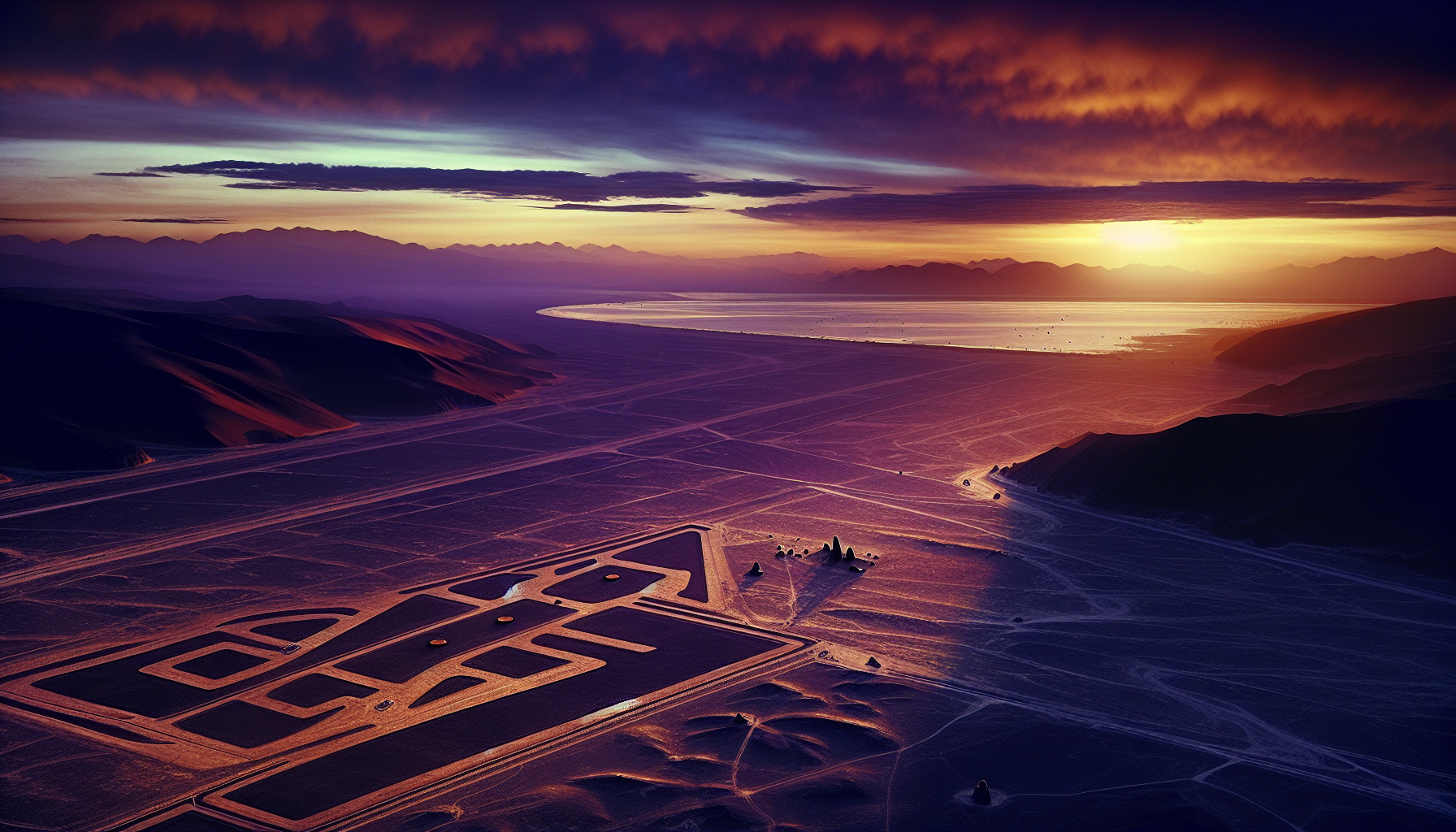
Standing at the edge of the plateau at sunset, with the surface stones turning copper and the long shadows of the trapezoids reaching toward the river valleys, the lines feel less like a riddle and more like a long conversation between a community and its land. The conversation has not ended. New figures keep emerging. The most useful response a modern reader can offer is patience, and a willingness to let the desert keep answering on its own terms.
Frequently Asked Questions
How old are the Nazca Lines?
The geoglyphs were made over roughly eight centuries, between about 200 BCE and 650 CE. The earliest figures are usually attributed to the late Paracas culture, while the later straight lines and trapezoids belong to the Nazca culture proper. Radiocarbon dates from offerings found along the lines support this range.
Who first studied the Nazca Lines scientifically?
Peruvian archaeologist Toribio Mejia Xesspe described the lines in 1927, after walking among them. American historian Paul Kosok photographed them from the air in 1941. Maria Reiche, who began her work the same year, mapped them in detail for fifty years and became the field’s most public advocate.
Can the Nazca Lines be seen from the ground?
Most of the smaller geoglyphs and the long straight lines are visible at ground level, especially from the low hills that border the pampa. The largest biomorphs, however, only resolve into recognizable figures from elevation. Today most visitors view them from light aircraft or from a designated observation tower along the Pan-American Highway.
Why did the Nazca culture make the lines?
Scholarship currently favors a layered ritual purpose. Maria Reiche read the lines as an astronomical calendar, Anthony Aveni softened that reading with statistical surveys, and Markus Reindel and Johny Isla have argued that the figures formed a ritual landscape oriented toward water and fertility. Most specialists now accept that several functions overlapped on the pampa.
What is the largest figure on the pampa?
Among the biomorphs, the pelican or heron is the longest at roughly 285 meters. Among the geometric figures, several trapezoids exceed a kilometer in length. The straight lines themselves can run for more than ten kilometers without breaking, depending on the terrain.
Are the Nazca Lines protected today?
Yes. UNESCO inscribed the site as a World Heritage cultural property in 1994. The Peruvian Ministry of Culture maintains restricted access, satellite monitoring, and a buffer zone around the protected area. Damage from squatters, vehicles, and climate-driven rainfall remains an active concern.
Are new geoglyphs still being discovered?
Yes. A Yamagata University team led by Masato Sakai reported more than 140 new figures in 2022, identified through machine-learning analysis of aerial imagery. Drone surveys continue to reveal small or eroded geoglyphs that earlier ground and air surveys missed.
Were the Nazca Lines made by extraterrestrials?
No. The construction technique is well documented, the imagery matches Paracas and Nazca ceramic art, and excavations at the lines have produced offerings consistent with Andean ritual practice. The extraterrestrial reading, popularized in the late 1960s, has no support in the archaeological record.


