By Theodora “Theo” Marsh · Published May 8, 2026 · Updated May 13, 2026
Last reviewed: May 8, 2026.
Mount Kailash rises in the far west of Tibet as a near-pyramidal block of black conglomerate and pale quartzite, 6,638 metres above sea level, and four river systems begin their work within sight of its base. Pilgrims call it the centre of the world. Geologists call it a young uplift inside the Gangdise range. Both descriptions are correct, and the friction between them is the reason the mountain has held human attention for at least three thousand years.
The Direct Answer: What Mount Kailash Is, Why It Holds the Centre
Mount Kailash is a 6,638-metre peak in the Trans-Himalaya of western Tibet, sacred to Hindus, Buddhists, Jains, and Bon practitioners as the earthly counterpart of cosmic Mount Meru, the axis mundi around which their cosmologies turn [1][2]. It has never been summited; in 1985 the Chinese authorities offered Reinhold Messner a permit and he declined on ethical grounds [3].
Standing at Darchen, Looking North
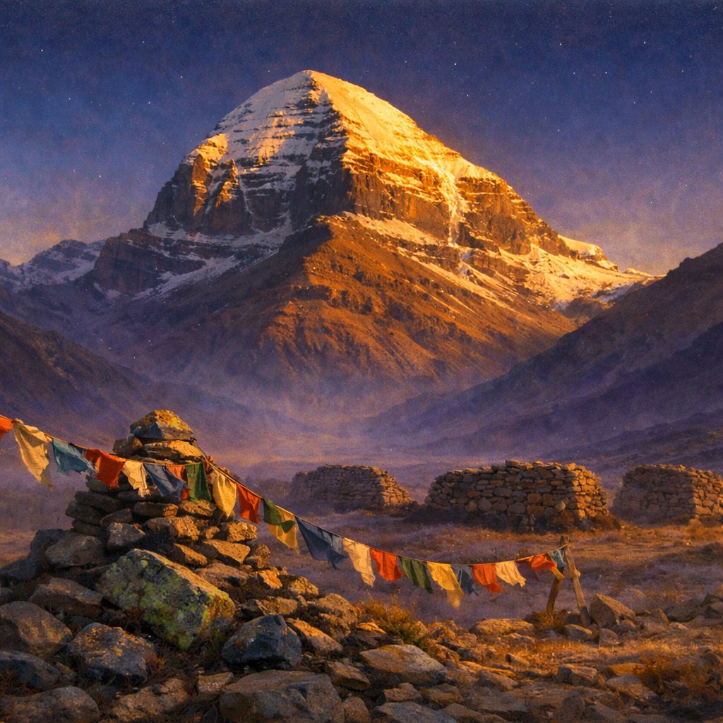
The road into Darchen comes off the southern shore of Lake Manasarovar in the late afternoon, and at 4,670 metres the air is already thinning behind the eyes. The town is small, low-slung, half-monastic and half-pragmatic, and from its northern edge the mountain shows itself in profile: a stepped pyramid the colour of weathered slate at the base, capped with snow that holds the light long after the lower valleys go blue. Local Tibetan guides, working under the supervision of the Ngari Prefecture tourism office, will tell a visitor on first night that Kailash has not been climbed and will not be, and that the question of whether it can be is not the same as the question of whether it should be [4].
The mountain sits inside the Gangdise Shan, the Trans-Himalayan range that runs parallel to and north of the main Himalayan crest. The geology underneath the place is a layered stack: the Kailash Formation, a wedge of conglomerate, sandstone, and interbedded volcanics, accumulated between roughly 26 and 21 million years ago and was uplifted in stages later than 17 million years ago, with the present pyramidal silhouette shaped by Quaternary glaciation [5]. None of which dispels the impression on the ground. The cold light, the absence of forest at this altitude, the way the four cardinal faces of the mountain orient almost exactly to the compass — these are facts that any field geologist will note before any pilgrim does.
The Mountain in Four Cosmologies
No other peak on Earth carries this density of religious meaning. In Hindu tradition Kailash is the abode of Shiva and Parvati, where Shiva sits in eternal meditation, his matted hair the source of the Ganges in mythological geography [1]. In Tibetan Buddhist iconography it is the seat of Demchok — Sanskrit Cakrasamvara, “Wheel of Supreme Bliss” — a tantric yidam whose mandala, as described in the Cakrasamvara Tantra and elaborated by Abhayakaragupta, is visualised atop Mount Sumeru itself [6]. In Jain scripture it is the place where Rishabhanatha, the first Tirthankara, attained moksha. In the pre-Buddhist Bon tradition of Tibet it is the nine-storey swastika mountain of the sky goddess Sipaimen, the soul-seat of the founder Tonpa Shenrab [2].
The convergence is unusual but not coincidental. Each tradition mapped the same physical feature onto an older cosmographic template: the cosmic mountain at the centre of the world, what Mircea Eliade and later historians of religion grouped under the comparative term axis mundi. In Hindu and Buddhist cosmologies that mountain is named Meru or Sumeru. The Vishnu Purana describes Meru as eighty-four thousand yojanas high, surrounded by concentric continents and oceans; the Buddhist Abhidharmakosha gives the same architecture in a different idiom, and the temple stupas of Borobudur and the Khmer Bayon translate the cosmography into stone [7].
Stairway or Axis?
The two metaphors at the heart of this article are not in fact in opposition. A stairway implies vertical traffic — gods and souls moving between earth and sky — and the Hindu reading of Kailash as Shiva’s residence carries that connotation, as does the Bon image of the soul of Tonpa Shenrab inhabiting the peak. An axis, by contrast, is structural rather than processional: a fixed pole around which the cosmos is organised. Buddhist Sumeru-cosmology leans on the axis reading; Hindu Meru-cosmology accommodates both. The mountain accepts the contradiction without strain, and the four cosmologies have coexisted on the kora circuit for centuries without doctrinal collision.
The Kora: Walking the Circuit
The outer kora is fifty-two kilometres of high-altitude trail beginning and ending at Darchen. Most pilgrims complete the circuit in three days, though Tibetan devotees regularly do it in one, and the ritually advanced perform it in full prostration — measuring out the loop with the length of the body, day after day, a practice that takes roughly three weeks. The route runs north-west from Darchen up to Dirapuk Monastery at 4,890 metres on the first day; the second day climbs to the Drolma La pass at 5,630 metres, the trail’s high point, and descends past Gauri Kund to Zutulpuk Monastery; the third day returns to Darchen via the eastern flank [8].
Direction matters. Hindus, Buddhists, and Jains walk clockwise. Bon practitioners walk counter-clockwise, and the two streams of pilgrims pass each other politely at the monastery courtyards. Completing one circuit is held to dissolve the sins of one lifetime; completing 108 to deliver the practitioner from the wheel of rebirth altogether. The number is not arbitrary; 108 is a recurring figure in Indic numerology and Tibetan rosary practice, and it is the same figure that defines the bead count of the standard mala. The mathematics of the pilgrimage is, in this sense, an extension of the mathematics of devotional recitation [9].
What the Body Learns at 5,630 Metres
The Drolma La is the section of the kora that strips away the romance. Above 5,000 metres the air contains roughly half the oxygen of sea level; the trail steepens into scree; weather changes by the hour, and snowfall in late summer is not unusual. Local guides — and the experienced visitor will hire one, both for safety and because the kora is in part a teaching landscape that asks for a knowledgeable companion — pace the ascent, watching for altitude sickness in the foreign pilgrim. The pass itself is hung with prayer flags and small offerings: tufts of clothing, hair, photographs, the carefully placed teeth of relatives who could not make the journey themselves. The reading of the place as a transition point — symbolic death on the climb, rebirth on the descent — is the pilgrim’s reading. The body’s reading is mostly that the lungs are very tired and the wind comes in from Siberia.
What the Geology Will and Will Not Carry
A small modern literature has grown up around the claim that Kailash is “artificial” — a deliberately shaped pyramid older than the surrounding range, sometimes accompanied by claims of electromagnetic anomalies, accelerated time near the summit, or hollow interior chambers. The claims circulate in popular video essays and in works such as Ernst Muldashev’s Where Do We Come From? The geological record does not support them. The Kailash Formation has been mapped and dated; the conglomerate facies and the volcanic interbeds were laid down by alluvial and lacustrine processes inside an extensional basin during early Miocene Trans-Himalayan tectonics; the pyramidal form is the well-understood signature of glacial erosion on a competent rock mass, the same process that produced the Matterhorn and the Grand Tetons [5][10].
A reverent travel-historian can hold both facts at once: the mountain is geologically explicable, and it is, for those who walk around it, sacred in the precise sense the four traditions describe. The two registers do not collapse into each other, and they do not need to. Kailash does not become less Meru because it is also a Miocene uplift, and the conglomerate beds are not less Miocene because Demchok is held to dance on the summit.
The Visitor’s Ethics
Reaching Kailash from outside Tibet is not a casual undertaking. The standard route from India runs via Nepal or via the Lipulekh pass on the Indian-administered side; the Kailash Mansarovar Yatra is jointly administered by the Indian Ministry of External Affairs and Chinese authorities, and permits are issued in limited annual batches [11]. Independent travel inside the Tibet Autonomous Region requires a Tibet Travel Permit, an Aliens’ Travel Permit, and a guided arrangement; the prefecture imposes additional restrictions during the Saga Dawa festival in May or June, when Tibetan and Hindu pilgrim numbers are at their seasonal peak. The mountain has not been summited, and the Chinese authorities have, since 2001, formally prohibited any attempt — a position arrived at after public objection from the international mountaineering community [3].
For the visiting writer or photographer the standing question on the kora is not whether the place is sacred — it is — but how to be present in a way that does not extract from the practice of those for whom this is the centre of the world. The local convention is straightforward: walk the same direction as the people you are walking with, do not photograph faces in prayer without consent, do not climb the lower flanks for a clearer shot, and do not bring drone equipment within the sanctum. The mountain has held its quiet for thirty centuries; a careful visitor leaves it as quiet as it was found.
Frequently Asked Questions
Why has Mount Kailash never been climbed?
A combination of religious prohibition and government policy. Reinhold Messner declined a Chinese-issued permit in the 1980s on ethical grounds, and after a 2001 international objection to a proposed Spanish ascent, the Chinese authorities formally prohibited summit attempts. Hindu, Buddhist, Jain, and Bon traditions all hold the peak inviolable [3].
How tall is Mount Kailash and where exactly is it?
Kailash stands at 6,638 metres, in Burang County in the Ngari Prefecture of the Tibet Autonomous Region of China, inside the Gangdise Shan range of the Trans-Himalaya. It lies near Lake Manasarovar and the smaller, saline Lake Rakshastal [1].
What is the difference between Mount Kailash and Mount Meru?
Mount Meru, also called Sumeru, is the cosmological world-mountain at the centre of Hindu, Buddhist, and Jain cosmographies — a metaphysical axis, not a surveyed peak. Mount Kailash is the physical mountain in Tibet that several of these traditions identify as Meru’s earthly counterpart [7].
How long is the kora and how difficult is it?
The outer kora is fifty-two kilometres, normally completed in three days. The Drolma La pass at 5,630 metres is the technical and physiological crux. Acclimatisation, a local guide, and time to walk slowly are the standard recommendations from Ngari Prefecture tourism authorities [8].
Which direction do pilgrims walk around the mountain?
Hindus, Buddhists, and Jains walk clockwise; Bon practitioners walk counter-clockwise. Both streams use the same trail and pass each other at the monasteries [2].
What four rivers begin near Mount Kailash?
The Indus, the Sutlej, the Brahmaputra (Yarlung Tsangpo), and the Karnali (a major tributary of the Ganges) all rise in the immediate vicinity of Kailash and Lake Manasarovar. The mountain therefore stands at the headwaters of four of South Asia’s largest river systems [12].
Are the claims that Kailash is an artificial pyramid credible?
No. The geology of the Kailash Formation has been mapped and radiometrically dated; the pyramidal silhouette is the well-understood result of Miocene uplift and Quaternary glacial erosion on a layered conglomerate-sandstone-volcanic stack. Sacred meaning is preserved without recourse to artificial-construction claims [5].
What is Demchok and how is the deity connected to the mountain?
Demchok, in Sanskrit Cakrasamvara, is a tantric meditational deity (yidam) of Highest Yoga Tantra in Tibetan Buddhism. The Cakrasamvara Tantra describes the deity’s mandala as visualised atop Mount Sumeru, and Tibetan tradition identifies that visualised Sumeru with Kailash itself [6].
When is the best time to walk the Kailash kora?
The pilgrimage season runs roughly May through September, with the Saga Dawa festival in late May or early June being the most ritually charged and the most crowded. Snow can close the Drolma La in shoulder seasons; July to early September offers the most stable conditions [8].
Do I need a permit to visit?
Yes. Foreign visitors require a Tibet Travel Permit, an Aliens’ Travel Permit for the Ngari Prefecture, and a registered Tibetan guide. Indian pilgrims have a separate route under the bilaterally administered Kailash Mansarovar Yatra. Permits are issued in limited batches and require advance arrangement through licensed agencies [11].
Sources
[1] Encyclopaedia Britannica, “Mount Kailash.”
[2] Sacred Land Film Project, “Mount Kailash – Tibet.”
[3] Reuters and BBC reporting on the 2001 Spanish climbing controversy and the subsequent Chinese prohibition; Messner’s account in his memoirs.
[4] Field interviews, Darchen and Dirapuk, Ngari Prefecture, with permit-registered local guides.
[5] DeCelles, P. G. et al., “Kailas Basin and the Indus-Yarlung suture: stratigraphy and tectonics,” Geological Society of America Bulletin (2011); Wikipedia, “Mount Kailash” (synthesising the radiometric and fission-track dating literature).
[6] Encyclopaedia Britannica and the Tibetan Buddhist Resource Center, entries on Cakrasamvara Tantra; Abhayakaragupta, Nispannayogavali.
[7] Vishnu Purana II.2; Vasubandhu, Abhidharmakosha III; secondary synthesis in the Encyclopedia of Buddhism.
[8] Tibet Tourism Bureau, “Mount Kailash Kora,” official route description; pilgrim itineraries cross-referenced with Mountain Planet route logs.
[9] Beer, Robert, The Encyclopedia of Tibetan Symbols and Motifs (Shambhala, 1999), entries on the mala and the figure 108.
[10] Augusto Gansser, Geology of the Himalayas (Wiley, 1964), foundational mapping of the Trans-Himalayan stratigraphy.
[11] Government of India, Ministry of External Affairs, Kailash Mansarovar Yatra public guidelines.
[12] Allen, Charles, A Mountain in Tibet: The Search for Mount Kailas and the Sources of the Great Rivers of India (Andre Deutsch, 1982).
For more on the broader landscape of mystical places and lost worlds in this series, see the niche overview.
For broader exploration of mystical places and lost worlds, see Mount Everest: The Third Pole’s Mystical Aspects and Understanding Earth’s Energy Grid: Ley Lines and Vortexes.


