By Emilia Wellesley · Published May 7, 2026 · Updated May 13, 2026
In the western desert of southern Egypt, about a hundred kilometers west of Abu Simbel and the modern shoreline of Lake Nasser, a small group of weathered sandstone slabs sits low against the pale floor of an ancient lakebed. The site is called Nabta Playa. The slabs are not impressive in the way of Karnak or Giza. They are a meter or two of stone above the sand, leaning at angles, set in a circle no bigger than a small room. Yet the dates that surround them, the herding economy that built them, and the alignments their excavators have proposed have rearranged how prehistorians talk about early astronomical observation in Africa. Nabta predates Stonehenge by roughly two thousand years, predates the first pharaohs by several thousand more, and has become, for one wing of the field, the earliest stone observatory anyone has yet found.
Direct Answer: What Is Nabta Playa?
Nabta Playa is a Late Neolithic ceremonial and habitation site in the Egyptian Western Desert, occupied by cattle-herding peoples between roughly 9,000 and 5,500 BCE. Its small calendar circle of upright sandstone slabs, dated to about 7,500 to 7,000 BCE, is widely treated as among the earliest known megalithic alignments. It predates Stonehenge by about two thousand years.
Discovery in 1974: Salvage Archaeology and the Aswan High Dam
The American archaeologist Fred Wendorf (1924-2015), then at Southern Methodist University, first recorded the Nabta basin in 1974, in the wake of the great salvage campaign occasioned by the Aswan High Dam. The dam’s reservoir, eventually named Lake Nasser, was filling the Nile valley behind it and threatening to submerge centuries of unrecorded archaeology along the riverbanks of Nubia. UNESCO had organized the spectacular relocation of Abu Simbel and the Philae temples between 1964 and 1968. Wendorf’s project, the Combined Prehistoric Expedition (CPE), turned its attention away from the riverbanks toward the open desert that the rising waters would not flood, and toward a much earlier prehistory than the pharaonic sites that had drawn the world’s cameras [1].
Wendorf and his Polish colleague Romuald Schild (born 1936) of the Polish Academy of Sciences led the CPE through almost three decades of fieldwork in the Western Desert, with seasons running from 1973 to 2003. Nabta proper sits in a shallow basin that, in the early Holocene, held a seasonal lake whenever the summer monsoons reached far enough north. The CPE recorded the lakebed, the surrounding habitation areas, the cattle burials, the small stone circle, and a scatter of larger megalithic features over a working area of roughly ten square kilometers. The fieldwork was painstaking. The published reports, first in journals such as Archaeology and the Journal of Field Archaeology, were synthesized in the two volumes of Holocene Settlement of the Egyptian Sahara, edited by Wendorf and Schild and published by Kluwer in 2001 [2].
The Nabtan Culture: Herders, Not Farmers
The people who used Nabta were cattle pastoralists, not settled farmers. The distinction matters. Mainstream readings of early Egyptian prehistory had long imagined that the trajectory toward dynastic civilization ran from incipient cereal farming on the Nile floodplain into village settlement and finally into the kingship of the Naqada cultures. The CPE evidence at Nabta complicated that picture. The lakeshore camps preserved hearths, post-built shelters, grinding stones for wild sorghum and other grasses, and faunal assemblages dominated by Bos primigenius f. taurus, the early African domesticated cow. Cattle bones appear at Nabta as early as the ninth millennium BCE, and the question of whether African cattle pastoralism arose independently of Near Eastern domesticates, or by transfer across the Sinai, is one the CPE evidence helped to open [3].
The picture that emerges is of seasonal occupation. When summer rains pushed the monsoonal front north into what is now hyperarid desert, the playa filled, the grasses returned, and the herders moved into the basin with their cattle. When the rains failed, the basin dried, and the people moved elsewhere. Over centuries this pulse of occupation laid down stratified deposits that the CPE could read. The hearths, the bone middens, the lithic scatters, and the wells dug into the lakebed when the surface water ran shallow all preserve the texture of a mobile herding life conducted at the climatic edge.
The Cattle Burial Cluster
Among the most striking features of the Nabta record is a cluster of formal cattle burials. Stone-roofed pits, lined and capped with flat sandstone slabs, contain articulated cattle remains, arranged with intent rather than discarded. The earliest of these pits date from roughly the seventh millennium BCE. The CPE interpreted them as ceremonial deposits, expressions of the herding community’s investment in the cattle that anchored its survival. The cattle burials prefigure, by several thousand years, the bovid imagery that recurs in early Egyptian iconography: the cow-goddesses Bat and Hathor, the bull-king motifs of the Late Predynastic, the ceremonial palettes of Hierakonpolis. Whether one reads a direct cultural lineage from Nabta into the Nile valley or only a parallel valuation of cattle in cousin cultures, the burials at Nabta sit very early in the African archaeological sequence of bovine veneration [4].
The Calendar Circle and the Megaliths
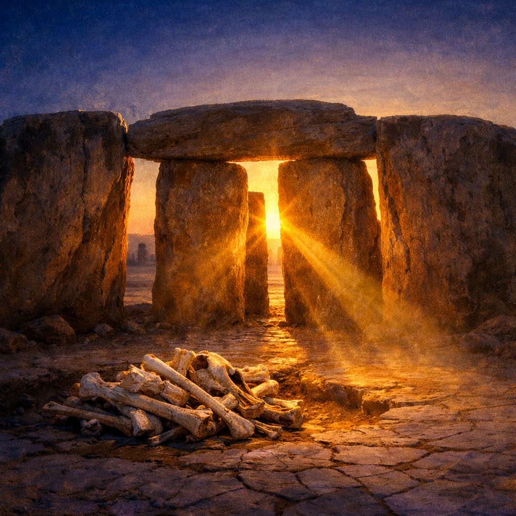
The feature that has carried Nabta into wider public awareness is small. It sits roughly a kilometer from the main habitation areas, on a slight rise above the playa floor, and consists of a roughly four-meter ring of upright sandstone slabs and lower flat stones, with two pairs of taller “gate” slabs aligned across the circle. The CPE designated it the Calendar Circle and assigned it, on stratigraphic and radiocarbon grounds, to roughly 7,500 to 7,000 BCE. Around the same horizon and in nearby loci sit the so-called megaliths proper: groups of larger sandstone blocks, some weighing several tonnes, dragged from outcrops a few hundred meters away and set into shaped pits. The CPE counted around thirty such megalithic features across the Nabta basin [5].
A reader walking the site today encounters far less drama than the published descriptions might suggest. The Calendar Circle stones, originally upright, are now mostly toppled. The megaliths sit weathered low against a pale desert that conceals their original setting. Since 2007 the site is also partially relocated: several of the most diagnostic stones, including reconstructed elements of the Calendar Circle, were transferred to the Nubia Museum in Aswan and to the Egyptian Museum in Cairo for conservation and public display, with replicas left at the original site [6].
The Malville 1998 Nature Paper: A Solstice Reading
In April 1998, the journal Nature published a short article by Wendorf, Schild, the astronomer J. McKim Malville of the University of Colorado Boulder, the geographer Ali A. Mazar of the Geological Survey of Egypt, and the Polish geomorphologist Halina Krolik. The paper, titled “Megaliths and Neolithic astronomy in southern Egypt,” reported that on the published coordinates and the published ground plan, the two pairs of “gate” slabs of the Calendar Circle aligned, within the precision the surface plan permitted, with the position of the rising sun on the summer solstice as it would have stood at the latitude of Nabta around 6,500 to 5,500 BCE. The Nature paper additionally noted that one of the larger megalithic alignments outside the circle pointed in the same period to the rising of Sirius, the brightest star in the night sky and a calendrical anchor in later Egyptian astronomy [7].
The Malville reading is conservative. It claims that Nabta’s builders observed and recorded the seasonally meaningful summer solstice sunrise, the moment when the monsoonal rains were due to return to the playa. It does not claim a worked-out predictive astronomy, a star catalog, or a cosmology. The argument rests on three legs: the directional fit of the gate slabs against the calculated solstice azimuth in the relevant epoch, the same alignment for a second slab pair across the circle, and an external megalith line oriented on the rising azimuth of Sirius corrected for precession. The paper passed Nature peer review and has been the standard reference for the astronomical reading of Nabta for more than a quarter century. Most working Saharan prehistorians, on this end of the question, accept the solstice claim as the most economical explanation for a feature the desert is unlikely to have produced by chance [7].
Why the Solstice, Specifically
The cultural fit is the part of the Malville reading that does the most quiet work. For a herding people whose annual cycle depended on the return of the rains, the heliacal observable that mattered was the moment in the year when the monsoonal front would push north again. Marking that azimuth with a stone and a “gate” was useful in a way that marking, for example, a winter solstice or an equinox was not. The same logic later organized the Egyptian state’s astronomical priesthood around the heliacal rising of Sirius and the inundation of the Nile. Nabta, on the Malville reading, sits at the very beginning of that long African tradition of binding seasonal observation to the calendar of subsistence.
The Brophy 2002 Hypothesis: Flagged as Fringe
A second, much more expansive astronomical reading of Nabta appeared in 2002 in The Origin Map, a self-published trade book by the American physicist Thomas G. Brophy. Brophy argued that the small stones inside the Calendar Circle and the placement of the larger megaliths around it encoded a star-map of the constellation Orion, that the Belt-and-Sword stones in the megalithic field reflected Orion’s three Belt stars in their precessional position around 16,500 BCE, and that the entire site functioned as a deep-time astronomical archive whose makers possessed knowledge of stellar distances and galactic geometry on a scale far beyond anything the published mainstream archaeology had attributed to early Holocene herders [8].
The Brophy claims do not sit inside the mainstream of Saharan or astroarchaeological research. They are not published in peer-reviewed journals; the trade-book format does not impose the source criticism a Nature submission imposes; the precessional dates Brophy invokes are several thousand years older than the radiocarbon-anchored construction of the megaliths themselves; and the asserted knowledge of stellar distances and galactic structure has no parallel in any other early Holocene material record. Saharan prehistorians, Wendorf and Schild among them, declined to extend their solstice reading to encompass Brophy’s. The Origin Map circulates widely in popular astroarchaeological literature and online, and the reader who wants to engage with Nabta will encounter Brophy’s framework in many secondary venues. The honest position is to name the framework, name where it sits relative to the field, and let the reader hold the two readings apart. Wendorf-mainstream is solstice-only and provisional. Brophy-fringe is far more ambitious and unsupported by the controlled archaeology of the site [9].
Abandonment Around 5,500 BCE: A Climatic Story
Nabta was not destroyed. It was abandoned. Around 5,500 BCE the African Humid Period, the long mid-Holocene wet phase that had pushed monsoonal rains over the central and eastern Sahara, drew down. The summer rains retreated southward. The playa stopped filling reliably enough to support cattle. The stratigraphic record at Nabta and at sister sites such as Bir Kiseiba, also worked by the CPE, shows the lakeshore camps thinning out across the sixth millennium and ending in the early fifth. Where the herding communities of the Western Desert went is one of the open questions the CPE was set up to answer. The likeliest answers point east toward the Nile valley, where the alluvial floodplain offered an alternative subsistence base, and south into the Sahel, where some monsoonal rains still reached. Nabta’s abandonment, in this reading, is not a collapse but a forced migration tracked closely by climate [10].
The pre-dynastic cultures of the Nile valley, the Badarian (around 4,400 to 4,000 BCE), the Naqada I, II, and III sequences (roughly 4,000 to 3,100 BCE), and the early dynastic state under Narmer around 3,100 BCE, all rise after Nabta’s abandonment, in valley territories that may well have absorbed Saharan herders carrying their cattle, their grinding stones, and their iconographic vocabulary into the river floodplain. The continuity is not proven beyond doubt. It is also not implausible. The cattle burials at Nabta and the bovine veneration of pharaonic Egypt look enough alike to invite the question without forcing the answer.
Nabta in Context: Older Than Stonehenge, Older Than the Pharaohs
A useful comparison helps the dates settle. The earliest mound and ditch at Stonehenge, on Salisbury Plain in southern England, dates to roughly 3,000 BCE; the bluestone phase to about 2,500 BCE; the great sarsen circle to roughly 2,400 to 2,200 BCE. The first dynasty of Egypt begins around 3,100 BCE under Narmer at Hierakonpolis and Abydos. The Calendar Circle at Nabta, on the published radiocarbon, predates Stonehenge by approximately two thousand years and the unification of Egypt by approximately four thousand. The point is not that Nabta is “the original” Stonehenge in any genealogical sense. The two sites had no contact and likely no shared cultural inheritance. The point is that megalithic alignment to the sky is older in Africa than in Europe by a margin the desert preserved and twentieth-century salvage archaeology recovered.
For the lay reader who reaches for “Africa’s Stonehenge” as shorthand, the framing is fair on chronology and not on culture. Nabta is its own thing: a small stone circle at the southern edge of the early Holocene wet Sahara, raised by cattle herders for whom the return of the summer rains was the calendar that mattered most.
What the Site Licenses, and What It Does Not
A useful discipline for an ambiguous site is to ask what claims its surfaces actually license. Nabta’s surfaces license several. They license the presence of cattle pastoralists in the central Western Desert from at least the ninth millennium BCE. They license formal cattle burials in the seventh and sixth millennia. They license the existence of a small stone circle and a set of larger megalithic features dating to about 7,500 to 7,000 BCE, raised by people whose subsistence was tied to the seasonal monsoonal lake. They license, on the published Malville reading and within the precision of surface azimuths, that two pairs of slabs in the Calendar Circle align on the summer-solstice sunrise of the relevant epoch and that a separate alignment matches the rising azimuth of Sirius. They license the abandonment of the basin by the mid-sixth millennium, when the rains failed.
What Nabta does not license, on the controlled archaeology, is a worked-out predictive astronomy, a star catalog, knowledge of stellar distances, or any of the deep-time precessional readings that The Origin Map proposes. The honest reader holds the solstice claim as well-supported and the larger architectural cosmology as unattested. Nabta is enough on its own. A small circle of weathered stones in the bottom of an extinct desert lake, raised by people whose names will never be known, marking the day the rains were due. The page is short. It is also, on the African early-Holocene record, the earliest known page of its kind. That is enough.
For deeper context across the historical and archaeological mysteries archive, consider The Tower of Babel: Historical Evidence and Indus Valley: Trade and Communication.


